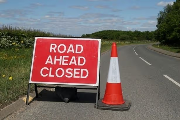
A road closure can turn a simple trip into a stressful experience. You may waste hours sitting in traffic, arrive late for an important appointment, or find yourself stuck on a route that is completely blocked. Knowing how to check road closures before leaving helps you plan better, choose safer routes, and avoid unnecessary delays.
The best way to check road closures depends on where you are traveling, why the road is closed, and how quickly you need updated information. Some closures are caused by accidents and may last only a few minutes, while others are planned because of construction, flooding, security activities, or road repairs.
This guide explains practical ways to find accurate road closure information, what sources to trust, and what to do when your usual route is unavailable.
Why checking road closures before traveling matters
Many drivers only search for road conditions after they encounter a problem. By that point, they may already be trapped in heavy traffic or forced to make sudden route changes.
Checking road closures ahead of time helps you:
- Avoid unexpected delays
- Find alternative routes
- Estimate your travel time more accurately
- Reduce fuel waste caused by unnecessary detours
- Stay safer during severe weather or emergency situations
For commuters, delivery drivers, business owners, and travelers, road closure information can directly affect schedules and costs.
For example, someone traveling to an airport may need to leave earlier if a major highway has partial closures. A delivery company may need to adjust routes if a bridge or major road is temporarily unavailable.
Use online maps to check current road closures
One of the easiest ways to check road closures is through digital mapping services. These platforms collect traffic information and often show blocked roads, accidents, construction zones, and slow-moving areas.
Google Maps is one of the most commonly used tools. To check road conditions:
- Open Google Maps on your phone or computer.
- Enter your destination.
- Select your route.
- Look for traffic warnings, blocked roads, or route changes.
- Check suggested alternative routes.
Google Maps may show road disruptions using colors, warning icons, or messages about delays.
However, map apps are not always perfect. A newly closed road may not appear immediately, especially during emergencies. For major travel decisions, it is better to confirm information with official sources.
Check government transportation websites
Government transportation agencies usually provide the most reliable information about planned road closures.
These websites may provide details about:
- Road construction
- Highway maintenance
- Lane restrictions
- Bridge closures
- Flood-related closures
- Emergency road restrictions
If you are traveling in a specific state, city, or country, search for the official transportation authority website in that area.
For example, many transportation departments provide online traffic dashboards where drivers can view current incidents and planned closures.
Official sources are especially important when traveling long distances because they usually have information directly from road authorities.
Follow traffic authorities on social media
Many road agencies use social media platforms to share quick updates about unexpected closures.
This is useful during:
- Major accidents
- Severe weather
- Flooding
- Public events
- Emergency repairs
A road may close suddenly because of an accident, and social media updates can sometimes appear faster than official websites.
When using social media for road closure information, verify that the account belongs to the official agency. Fake accounts and outdated posts can spread incorrect information.
Use traffic and navigation apps
Besides standard map services, several traffic applications focus specifically on road conditions.
Popular traffic tools can provide information about:
- Traffic congestion
- Accidents
- Road hazards
- Construction activity
- User-reported incidents
Waze, for example, uses reports from drivers to identify traffic problems and road disruptions.
User reports can be helpful because they may reveal issues before official updates are available. However, because the information comes from users, it should be treated as a helpful signal rather than the only source you rely on.
Check local news reports
Local news organizations often report major road closures, especially when they affect many people.
News reports can provide additional details such as:
- Why the road was closed
- Expected reopening times
- Areas affected
- Recommended alternatives
This can be useful when closures are caused by events such as flooding, accidents, protests, or major public gatherings.
Contact local authorities when information is unclear
Sometimes online information may be incomplete or outdated. If a road closure affects an important trip, contacting local authorities can provide confirmation.
You can check with:
- Traffic control departments
- Highway agencies
- Local government offices
- Police or emergency services
This is especially useful when traveling through unfamiliar areas where online information may be limited.
How to check road closures using Google Maps step by step
If you are using Google Maps, follow these steps:
Open the map application
Launch Google Maps on your smartphone or computer.
Enter your destination
Search for where you want to go and select directions.
Review the route information
Before starting navigation, check:
- Traffic colors
- Warning symbols
- Suggested route changes
- Estimated travel time
Look for alerts
Pay attention to messages about:
- Road closures
- Accidents
- Construction
- Delays
Compare alternative routes
If your normal route has problems, check other available options before starting your journey.
How to check road closures before a long trip
Long-distance travel requires more preparation because conditions can change along the way.
Before leaving:
- Check your entire route, not just your starting location
- Look for weather-related closures
- Check major highways and bridges
- Review official transportation updates
- Download offline maps if traveling through areas with poor internet access
For example, a driver traveling several hours may find that the first part of the journey is clear but a major highway section later has a closure. Checking the full route prevents surprises.
Common mistakes people make when checking road closures
Relying on only one source
No information system is perfect. A map app may miss a new closure, while a government website may not show user-reported delays.
Using multiple sources gives you a more accurate picture.
Checking too early
Road conditions can change quickly. Checking a week before traveling may not help if an accident happens on the day of your trip.
For important journeys, check again shortly before departure.
Ignoring weather conditions
Some closures happen because of weather, including:
- Heavy rain
- Flooding
- Snow
- Landslides
- Strong winds
Always consider weather reports along your route.
Not planning an alternative route
Knowing that a road is closed is only useful if you know what to do next.
Before traveling, identify possible alternative roads, especially when driving in unfamiliar locations.
What to do if you discover a road closure while driving
If you encounter an unexpected road closure:
- Avoid making sudden turns or unsafe maneuvers.
- Follow signs and instructions from traffic officials.
- Use navigation apps to find alternative routes.
- Stop safely if you need to review directions.
- Avoid entering restricted areas.
Do not attempt to bypass barriers or closed roads. A closure may exist because the road is unsafe.
How accurate are road closure updates?
Road closure accuracy depends on the source and how quickly information is updated.
Generally:
- Official transportation agencies are best for confirmed closures.
- Navigation apps are useful for live traffic conditions.
- Social media can provide fast updates but requires verification.
- News reports provide context but may not show every local closure.
For the best results, combine official information with real-time navigation tools.
Checking road closures in Nigeria
In Nigeria, road conditions can change because of construction projects, flooding, accidents, security situations, and major public events.
Drivers can check information through:
- Federal and state road agencies
- Local traffic authorities
- Navigation apps
- Verified government social media accounts
- Local news platforms
For major highways, it is especially important to confirm conditions before traveling because some disruptions may not appear immediately on digital maps.
A simple routine for avoiding road closure problems
Before leaving home:
- Open your navigation app.
- Check your route for warnings.
- Search for recent closure updates.
- Confirm information from official sources if the trip is important.
- Prepare an alternative route.
This simple habit can save time and reduce travel stress.
Road closures are often unavoidable, but being informed gives you more control. A few minutes spent checking conditions before a journey can prevent hours of delay and help you reach your destination safely.
Leave a Reply